WorldWideWiFi
This is exciting!
[TL;DR version: I'm a genius visionary, but I don't follow through.]
Really, this is exciting! But first, some background:
On the sixth of August, 2012, I finally aquired a Google Maps API key for an experiment.
I wanted to build an app, connected to Google Maps, that enabled users to share the locations of free and open Wi-Fi spots. It would be pretty basic, but I felt that it could be really useful. Who hasn't been stranded somewhere, in desperate need of a friendly Wi-Fi spot open for public use?
The app itself was planned to be able to find open access points, automatically test them for connectivity and some basic security checks, and connect to them. Once online, the app would post the GPS location of the spot for other users to find on a public map, and let the user find other spots to use.
The database behind all this would of course contain other types of open or at least somewhat open spots, completely open being preferred over spots using captive portals or demanding payment or memberships in order to allow access. All of this would have made it much easier to find connectivity when in need.
The only service remotely similar to what I wanted that I could find in Sweden at that time was Wifikartan.se.
While this service technically covered the "let me find wifi on a map" part, it was based on the creator's other map services, locating and rating more static things, such as sushi restaurants or cafes. Wi-Fi spots were manually entered and maintained by the site's users, and in combination with the rather volatile nature of many Wi-Fi spots this lead to a data quality level that I found unsatisfactory.
WorldWideWifi's data was to be automatically collected in the general case, and manually maintained for the subset of spots that people actually would care for enough to spend time on.
I felt that this approach would give a higher level of data quality and provide automatic maintenance of the database. It would have worked something like this:
- When a user entered a wireless network not previously recorded, the app would alert the user and ask for permission to connect to* and categorize** the network.
- Openness, ranging from "open" where it was possible to use essential ports, like 80, 443, 22, 6667 and the like, to "www only" for those strange places that call port 80 "the Internet". Due to spammers, I wouldn't have counted mail related ports as essential, though.
- Speed, measured against a few known good bandwidth targets
- Whether there is a captive portal or not, requiring some sort of confirmation before the network can be used. The categorizer would of course be aware of and able to fill in such confirmations before continuing the categorizing process.
- If payment is required
- When a user entered an already registered spot that hadn't been validated for a certain amount of time, the app would connect and run a series of validation tests, confirming the spot's status.
- If the user arrived at a spot, based on GPS location, that no longer was active, the spot would be marked as potentially unavailable in the map, and a notification would be sent to the spot maintainer if one existed. If the spot wasn't restored within a reasonable time, it would be unceremoniously deleted from the database.
* This would be illegal in some countries, which probably would become mostly white areas on the map. Automatically connecting to and categorizing open networks without user intervention would probably be illegal in even more countries.
** The categories would include, among other things:
The spot would then be submitted for inclusion in the database.
And how is this exciting?
It exists. Not in every detail the same as WorldWideWiFi, but close enough. About the same time in 2012, when I began my research for this project, a Swedish company was founded; Instabridge. Let me quote from their welcome letter:
----
With Instabridge you can:
1) Get free wifi all over the world
2) Use your friends wifi networks without having to input the password
3) Keep your wifi networks in sync between all of your devices
----
Point 1 covers the basics of WorldWideWiFi. A quick test of the app showed that it categorizes spots according to freeness (as in gratis, captive portals and such things) and speed, at least. I'm not sure it cares about openness (as in what you can access through the spot), and whether they prune the database automatically I do not know. The app's wording suggest that it's able to automatically categorize open spots without user intervention, but I haven't tried doing that yet. It's really keen on sending the user's personal data to Instabridge, though, in the name of convenience.
Points 2 and 3 are functionality that wasn't going to be covered by Worl... Let's call it WWWF from now on, ok? WWWF wasn't going to handle points 2 and 3. I didn't have any wish to be responsible for people's private network passwords.
It was planned to let WWWF members review the spots, though, much like wifikartan's service, and taking care of people's login credentials felt like enough responsibility.
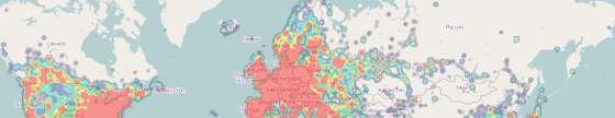
OpenCellID heatmap. Wi-Fi heatmaps seem to be scarce; this will have to do.
Photo by Markus591 (CC BY-SA).
Conclusion
In 2012, I envisioned a world wide Wi-Fi map, mainly powered by and accessed through a smartphone app. At about the same time, a company was founded around essentially that same vision, and in 2013, they got an award for being bloody geniuses. Good work!
![]()
![]()
![]()
![]()